Conny Waters - AncientPages.com - Central America’s untouched tropical rainforests may look like the epitome of wild, pristine nature, but a groundbreaking new study reveals they are actually growing in the invisible footprints of the ancient Maya.
Archaeologists using advanced airborne laser scanning have found that the structure of the Belizean jungle—including tree height and canopy thickness—is still heavily shaped by human engineering from thousands of years ago.
The study challenges the long-held belief that these old-growth forests are entirely natural ecosystems untouched by human history. Instead, researchers found that what we see today is a living legacy of ancient agricultural and urban planning.
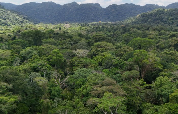
Credit: University of Exeter
"We know that modern land use is transforming tropical landscapes on an unprecedented scale," says lead author Dr. Sara Eshleman, a postdoctoral research associate on the Bladen Legacy project. "What this research reveals is that those landscapes already bear the deep ecological imprint of ancient civilizations. What we think of as 'pristine rainforest' may well owe much of its structure to the different ways that the Maya stewarded the land."
Mapping The Invisible Past
An international team of experts from the University of Exeter and the University of Texas at Austin conducted the research as part of the "Bladen Legacy" project, a UKRI-funded initiative exploring 13,000 years of human-environmental history in Belize.
To peer beneath the dense jungle cover, scientists analyzed Light Detection and Ranging (LiDAR) data collected over the Rio Bravo Conservation and Management Area. This region was once a bustling hub of Maya activity, home to major ancient centers like Wari Camp and Gran Cacao.
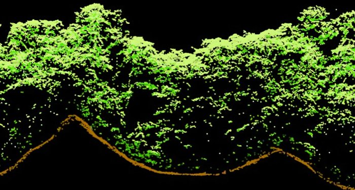
A LiDAR point profile captures the trees growing atop two ancient Maya structures in northwestern Belize. Credit: University of Exeter
By comparing the modern forest topography with the hidden ruins of Maya infrastructure mapped below, the team uncovered a distinct correlation between historical land use and current tree growth patterns.
The strongest patterns emerged around ancient farming sites, where the Maya engineered complex canal networks for wetland agriculture.
Thousands of years later, these deeply altered zones support significantly taller trees and denser canopies. Additionally, regions near abandoned homes and civic centers feature unique upper foliage structures. Researchers attribute this to limestone slowly leaching from crumbling stone structures into the soil, creating localized nutrient shifts that favor specific local species like the Ramón tree.
A Broad Ecological Impact
"What this research reveals is that those landscapes already bear the deep ecological imprint of ancient civilizations," noted Dr. Eshleman. She emphasized that modern land use is rapidly altering tropical zones, but the very structural foundation of these forests was already laid by historical Maya stewardship.
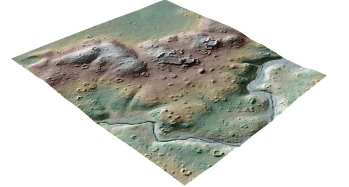
LiDAR reveals the intensive and extensive landscape alterations undertaken by the ancient Maya at the site of Gran Cacao. Credit: University of Exeter
While the data currently focuses on a localized segment of Belize, the implications could be vast. Thousands of similar structures, terraces, and field networks have been mapped via LiDAR across Central America.
"LiDAR surveys are revealing extensive networks of ancient settlements, terraces, walls and wetland fields across Central America," says Dr. Mark Robinson, a co-author from Exeter’s Department of Archaeology and History.
See also: More Archaeology News
"If this relationship that we have identified in Belize is found in these other areas, then that legacy of ancient Maya land management may well be influencing huge portions of our tropical ecosystem."
The team hopes to expand their research grid in future seasons to determine just how far this ancient botanical footprint extends.
The study was published in the journal Scientific Reports
Written by Conny Waters - AncientPages.com Staff Writer