
More Than 60,000 Ancient Maya Structures Obscured By Inaccessible Forest Revealed By LIDAR
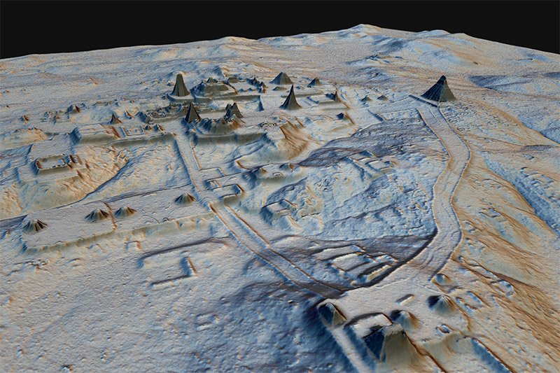
AncientPages.com - Researchers at Tulane University have documented the discovery of dozens of ancient cities in northern Guatemala through the use of jungle-penetrating Lidar (light detection and ranging) technology.
“Seen as a whole, terraces and irrigation channels, reservoirs, fortifications and causeways reveal an astonishing amount of land modification done by the Maya over their entire landscape on a scale previously unimaginable,” Tulane researcher Francisco Estrada-Belli, said in a press release.
Tulane University researchers Marcello Canuto and Francisco Estrada-Belli are part of a team of researchers who uncovered ancient cities in northern Guatemala through the use of jungle-penetrating LiDAR (light detection and ranging) technology. Credit: American Association for the Advancement of Science
Researchers analyzed lidar data covering over 2,100 square kilometers of the Maya Biosphere Reserve.
"Since LiDAR technology is able to pierce through thick forest canopy and map features on the earth’s surface, it can be used to produce ground maps that enable us to identify human-made features on the ground, such as walls, roads or buildings,” Marcello Canuto, director of the Middle American Research Institute at Tulane, said.
New technology makes it possible to study and visualize ancient Maya cities like never before. Credit: Luke Auld-Thomas and Francisco Estrada-Belli/PACUNAM
Specifically, the key identifications of this study are:
- 61,480 ancient structures in the survey region, resulting in an estimated population of 7 to 11 million at height of the Late Classic period (650-800 CE). The structures include isolated houses, large palaces, ceremonial centers and pyramids.
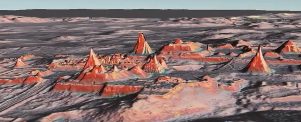
- 362 square kilometers of terraces or otherwise modified agricultural terrain and another 952 square kilometers of viable farmland, demonstrating a landscape heavily modified for the intensive agriculture necessary to sustainably support massive populations for many centuries.
- 106 square kilometers of causeways within and between urban centers and numerous, sizeable defensive earthworks. This substantial infrastructure investment highlights the interconnectivity of cities and hinterlands as well as the scale of Maya warfare.
Lidar (a type of airborne laser scanning) provides a powerful technique of identification and three-dimensional mapping of important archaeological features.
Particularly this time, Lidar proved to be a valuable tool in archaeology, particularly where the remains of structures may be hidden beneath forest canopies, report researchers in their paper published by Science.
AncientPages.com
More From Ancient Pages
-
 Eurasian Horse Riders Played Ball Games 3,000 Years Ago – Leather Balls Found In Graves Reveal
-
 Magnificent Pagodas In Indein Village And Undiscovered Secrets In The Myanmar Jungle
-
 Rare Artifacts Found In Nottingham’s Mysterious Caves On Display For The First Time
-
 On This Day In History: Gold Discovery In The Yukon – On August 16, 1896
-
 88 Ice Age Human Footprints In Utah Desert Shed New Light On Ancient Americans
-
 El Gigante Offers Lessons In Sustainability, Evolution And Human Adaptation, Courtesy Of The Holocene
-
 Rare Upper Paleolithic Human Remains Discovered In The Iberian Peninsula
-
 Beautiful Mosaics Reveal Ancient Secrets Of Unknown Roman City Ucetia In France
-
 3,000-Year-Old Twisted Gold Torc Discovered In Essex
-
 Amazing Painted Throne Room Of A Powerful Moche Queen And An Unknown Large Structure Discovered In Peru
-
 Genome Study Reveals How Human Populations Adapted, Survived, And Diversified In The Himalayas
-
 New Clues About A Potential Connection Between East Asian H. erectus And Denisovans
-
 Fall Equinox Explains Unusual Alignment Of Egypt’s Great Pyramids – Engineer Says
-
 Ruins Of A Roman-Era Bath And A Floor Mosaic Discovered In Central Anatolia
-
 On This Day In History: The Name Of America Used For The First Time On World Map – On Apr 25, 1507
-
 Neanderthals Changed Ecosystems 125,000 Years Ago
-
 On This Day In History: Captain James Cook Spotted The East Coast Of Australia – On Apr 19, 1770
-
 Ancient Legend Is Now Proven True: Sunken Treasure Of Gold And Silver Found
-
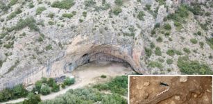
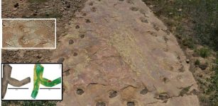 Ouray In Colorado – Looping Long-Necked Dinosaur Site Reveals Its Secrets
-
 Māori Connections To Antarctica May Go As Far Back As 7th Century