Conny Waters - AncientPages.com - A new archaeological find at Machu Picchu has caught the attention of scientists. Researchers used LiDAR technology to spot a main road at least 1.2 kilometers long, as well as possible platforms and terraces for future study.
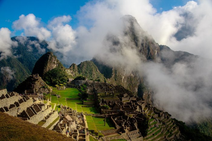
Machu Picchu through clouds. Credit: Wikipedia - CC0 1.0
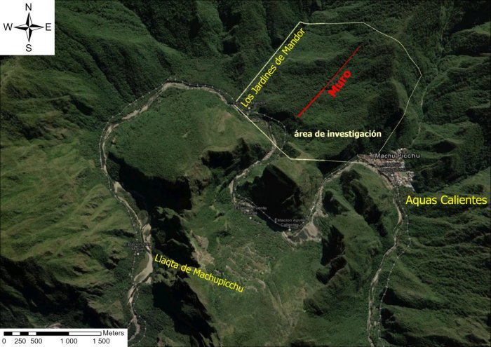
According to Peru’s Ministry of Culture, LiDAR surveys uncovered more than 2.5 kilometers of pre-Hispanic roads and more platforms and terraces near the Mandor wall, close to the llaqta of Machu Picchu. This Inca citadel, built in the 15th century, sits on a mountain ridge in southern Peru’s Eastern Cordillera at 2,430 meters (7,970 ft).
LiDAR Discoveries In The Andean Cloud Forest
Machu Picchu, often called the "Lost City of the Incas," is a well-known symbol of the Inca civilization and one of the most important archaeological sites in the Americas. Built around 1450, it likely served as an estate for Emperor Pachacuti, the ninth Sapa Inca of Cusco, who expanded the Inca Empire (Tawantinsuyu).
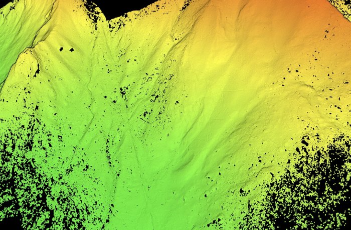
Researchers documented the LiDAR findings during early archaeological surveys in July 2026. They found a main road at least 1.2 kilometers long, with a zigzag pattern typical of Inca construction. While these features point to an Inca origin, more research is needed to confirm its age, purpose, and how it connects to other parts of the landscape.
Credit: Peruvian State
The survey at Machu Picchu National Archaeological Park used LiDAR technology to collect terrain data and find possible archaeological evidence hidden by thick vegetation and rough cloud forest. LiDAR, which stands for Light Detection and Ranging, is a modern tool that has become essential in archaeology. It works by sending out laser pulses and measuring their reflection to create detailed 3D maps, showing features that cannot be seen with the naked eye.
Credit: Peruvian State
The Mandor wall area, east of Machu Picchu, is especially interesting within the site’s cultural landscape. The new findings help us better understand pre-Hispanic life here and raise new questions about how this area fit into the territory, landscape, and movement around Machu Picchu.
These discoveries are the result of teamwork between the Andean Studies Center at the University of Warsaw and the Decentralized Directorate of Culture of Cusco. Their partnership supports research and conservation at Machu Picchu.
Credit: Peruvian State
After these findings, the Cusco Regional Directorate of Culture (DDC Cusco) started focused archaeological studies. These include field surveys and documentation to learn more about the features, age, purpose, and condition of the evidence found. They will also look at ways to protect, conserve, and improve these sites in the future.
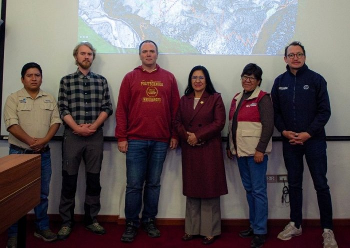
Dr. Jan Klaput from the Center for Andean Studies at the University of Warsaw led the survey and recording. Dr. Bartlomiej Cmielewski from Wroclaw University of Science and Technology managed the use of advanced remote sensing tools.

Credit: Peruvian State
The team also included archaeologist Jeff Rocky Contreras Soto from Apu Space and Dr. Pawel Dabek from Wroclaw University of Environmental and Life Sciences. Dr. Nino del Solar Velarde, who leads Archaeological Research Coordination at Machu Picchu for the Cusco Regional Directorate of Culture (DDC Cusco), supervised the fieldwork. The University of Warsaw provided funding.
Maritza Rosa Candia, executive director of DDC Cusco, said that using new technologies in archaeological research greatly increases what we know about Machu Picchu and helps guide future research and conservation.
See also: More Archaeology News
Prof. Dr. Mariusz Ziólkowski, director of the Center for Andean Studies at the University of Warsaw, pointed out that international scientific teamwork is key to advancing research and finding new archaeological evidence around Machu Picchu.
These findings help us better understand the complex network of roads, buildings, and spaces that made up the pre-Hispanic cultural landscape of Machu Picchu, which has been a UNESCO World Heritage Site since 1983.
Source: Peruvian State
Written by Conny Waters - AncientPages.com Staff Writer