
Long-Lost Viking Waterway Leading To Orkney, The Great Norse Empire – Discovered
Jan Bartek - AncientPages.com - Vikings were masters of the oceans. They traveled far and reached new lands because their longships were fast and could sail in shallow water.
Vikings’ fearless dragonships were the greatest technical and artistic achievement of the European Dark Ages and one of the reasons Norse warriors could conquer so much land. Seeing a Viking ship on the horizon led to panic and frightened people fled. Surely, Vikings’ arrival could only mean death, or maybe not?
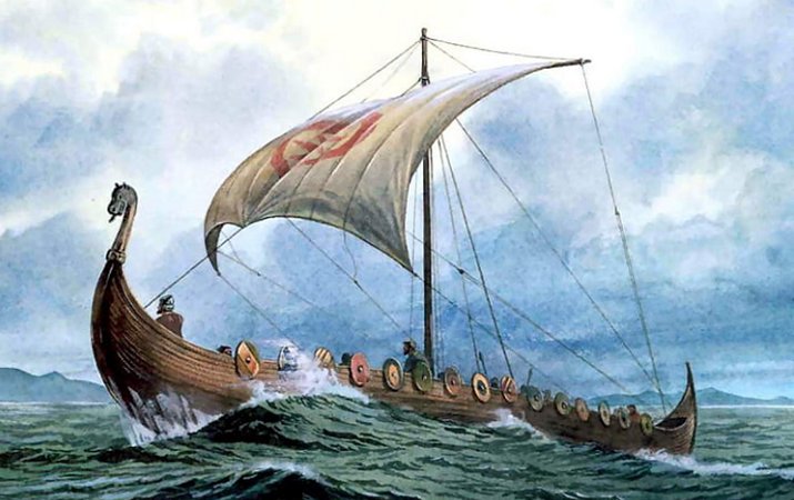
A Viking longship. Image source
The outcome of Vikings’ encounter with locals was not always deadly, but it’s true these warriors would not bother to cross the ocean just to pay foreigners a polite visit and shake hands.
Vikings traveled to new lands to conquer and Orkney became one of the places where they established a great Norse Empire.
Orkney - A Seat Of The Norse Empire
But how did Vikings reach Orkney? A study of Old Norse names combined with modern scientific methods, remote sensing geophysical mapping and sediment samples has revealed a lost Viking waterway running through the Orkney Mainland, connecting the North Atlantic and Scapa Flow, possibly forming the equivalent of an ancient ‘highway’.
Scientists from the Universities of the Highlands and Islands, St Andrews and Wales became curious when they noticed a series of Old Norse (Old Scandinavian) place names, connected to the sea and boats, located in the middle of the Orkney Mainland. Could this discovery be of importance? Researchers decided to investigate further and found more clues.
Orkney is located not more than twenty miles north of mainland Scotland. Nevertheless, historians agree Orkney’s culture has for many centuries been more Scandinavian than Scottish.
A lost Viking waterway that ran across Orkney and connected the North Atlantic and Scapa Flow 1,000 years ago has been discovered by archaeologists. Credit: University of St. Andrews
The most dynamic period of Orkney's history is most likely the invasion by the Vikings, who settled there in large numbers and established a powerful Norse Empire.
Norse Names Reveal Vikings' Lost Waterway
The famous Orkneyinga Saga, which is based on myths, legends, and history relates this interesting period in Orkney’s history. Considered one of the major literary works of its time, the Orkneyinga Saga was compiled sometime between 1192 and 1206 by an unknown Icelandic scribe or maybe even several scribes.
Vikings’ invasion is naturally the reason why names with Norse origins are prevalent on the west mainland of Orkney which was a key area of power for the Norse Earls from the 9th to the 12th century.
Scientists discovered the identified waterways provided easy access to the Earls’ stronghold on the Brough of Birsay for the transport of rents and taxes from the rich farms and estates surrounding the Loch of Harray. They also provided essential trade routes to the protected waters of Scapa Flow.
The medieval Viking names for farms and homesteads have long been known and studied in northern Scotland and the Isles.

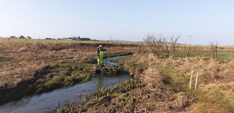
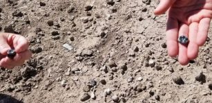
This is a bridge at the center of Dounby transect showing piers founded on bedrock. They found a stream channel cut into the bedrock. Credit: University of St. Andrews
In their science paper, researchers write, “the new study investigated some of the names that have sea or boat connotations used for places that today are far inland in central Orkney. Names such as Greenay, meaning shallow waters, or Knarston (Old Norse ‘knarrar staðir’) derived from the words for a transport vessel (Old Norse ‘knörr’) and a farm or homestead (Old Norse ‘staðir’) where these vessels were moored.
Warth, derived from Old Norse ‘varða’ (‘beacon’), may also seem obscure as it is in a low-lying land-locked position today. However, there is evidence from Denmark that the same name (Danish ‘warth’) was used for a ‘vagttårne’ (‘watchtower’) in low-lying locations along water routes, such as the Roskilde fjord.
Many such inland places are today located many miles from the open sea.”
A series of Old Norse place names, connected to the sea and boats, located in the middle of the Orkney Mainland initially drew the attention of the researchers.
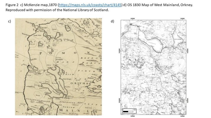
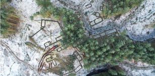
Researchers used remote sensing geophysical methods to map a series of now infilled channels that extended north from the Loch of Harray to the lochs of Sabiston and Boardhouse towards the Earls seat of power in Birsay.
The data was combined with information about the old landscape obtained from environmental records within sediment samples. These were cored from key sites throughout the area. The land is now dominated by agricultural activity and heavily modified by artificial drainage networks constructed over the last three centuries making it difficult to see anything of the old waterways at the surface today. However, once the scientific data was analyzed it was possible to model the pathways and link them to the nautically named locations.
The results showed that a complete route from Harray, through the Loch of Banks and including a portage at Twatt over to the Loch of Boardhouse into the earldom estates in Birsay was easily achieved.
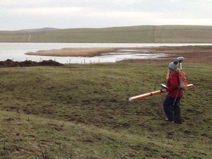
Scientists found there were waterways hidden that once would transport people and grain across the island via various homesteads. Credit: University of St. Andrews
The waterway network would have provided a shallow water routeway through which the Norse/Vikings were able to haul both their boats and heavy goods, such as grain.
Similar navigable waterways are known elsewhere in Scotland, for example, at Rubh an Dunain in Skye. This new work changes how we think about the transfer of goods and people in the west of mainland Orkney and perhaps enables historians and archaeologists to find more evidence of water transport in the Viking Age and Late Norse period in the Isles.”
“I am delighted with the outcome, as multiple pieces of written and landscape evidence suggested the existence of the waterway. The results will be used in our continued study of how the Norse used and organized the landscape of Orkney,” Dr. Alexandra Sanmark of the Institute for Northern Studies at the University of the Highlands and Islands said.
Written by Jan Bartek - AncientPages.com Staff Writer
More From Ancient Pages
-
 Magnificent Ancient Treasure Discovered In Crimea – But Who Does It Belong To?
-
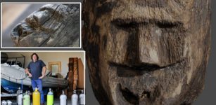 Underwater Secrets Of Lake Lednica And The Unique Wooden Face
-
 Huge Ancient Ceramic Workshop With Hundreds Of Stunning Artifacts Solves An Archaeological Mystery In Israel
-
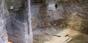 Abric Romaní Cave: New evidence indicates Neanderthals used to heat water some 60,000 years ago
-
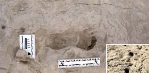 1.5-Million-Year-Old Footprints Of Two Different Species Of Human Ancestors Found At The Same Spot
-
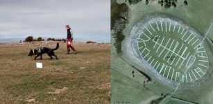 Fabel: World’s First Archaeology Dog Helps To Unravel The Mystery Of Sandby Borg
-
 Maya Storm God Huracán Taught That When We Damage Nature, We Damage Ourselves
-
 Evidence Of The Biggest Ever Solar Storm 14,300 Years Ago – Found In Ancient Tree Rings
-
 Fossils Suggesting New Species Of Ancient Humans – New Discovery
-
 Ancient Maya Nose Ornament Made Of Human Bone Discovered In Palenque
-
 Stone Artifacts Reveal Humans Lived In Philippines 700,000 Years Ago – Much Earlier Than Previously Thought
-
 Teeth Pendants And Prominent Status Of Elks In Stone Age – New Study
-
 Ruins Of Post-Medieval Brunell Township Discovered In Glen Brittle Forest On The Isle of Skye
-
 Ancient Burials Of World’s First Horse Riders Found Near The Black Sea
-
 Solar Eclipses And New Attempt To Date Homer’s Iliad And Odyssey
-
 The Wild Hunt And The Danger Of Seeing The Phantom Army Of Odin
-
 Researchers Confirm Museum Shrunken Head As Human Remains
-
 New DNA Evidence Rewrites Ancient History Of Pompeii
-
 Unknown Fragments Of Two Euripides Tragedies Found In Egyptian Grave
-
 On This Day In History: Zhao Kuangyin Became Emperor Taizu Of Powerful Song Dynasty – On Feb 4, 960