AncientPages.com - Rock art is one of the most intriguing records of the human past – it directly represents how our ancestors viewed their world. This provides a fundamentally different perspective compared to other archaeological items, such as stone artefacts.
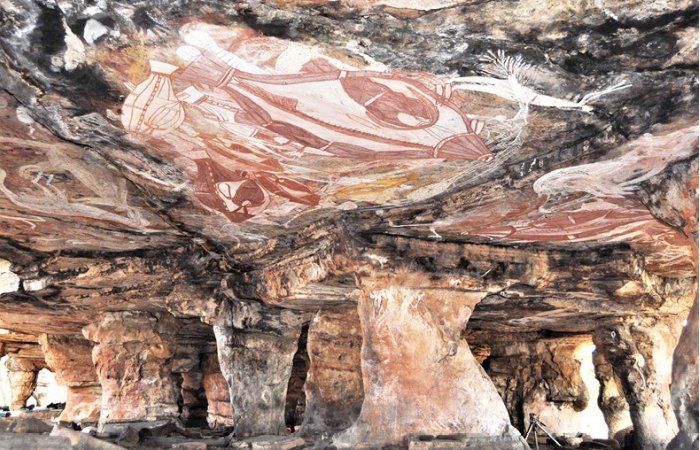
Rock art in the Gabarnmang Cave. Credit: Jean-Jacques Delannoy - CC BY-SA 4.0
Despite this beguiling potential, rock art research can be highly challenging. Different researchers can have contrasting interpretations of what the same image means. Sometimes they can’t even agree on what the rock art represents.
Given these difficulties, how can rock art contribute to understanding the past?
Our new research published in Archaeological and Anthropological Sciences uses an innovative approach to understand rock art in Arnhem Land in a fundamentally different way.
A dramatic landscape change
Our work concerns the Red Lily Lagoon area. This part of western Arnhem Land contains an internationally significant record of humanity’s past, including Australia’s oldest archaeological site.
It has also been the subject of dramatic landscape change as a result of sea levels rising significantly over the last 14,000 years.
The coastline moved from hundreds of kilometres away to right up against the cliffs in the Red Lily region, before retreating northwards about 50km to its current position. These changes would have had profound implications for people living in the area.
The complex landscape of sandstone cliffs and flat floodplains would have dramatically changed: from open savanna, to mudflat, to mangrove swamp. Eventually it would become the seasonally inundated freshwater wetlands that exist in the region today.
An astonishing rock art record
Arnhem Land has an astonishing rock art record that continues to be maintained by Traditional Owners today.
The rock art in Arnhem Land can be categorised into a number of different styles, which change over millennia. These styles, including the well-known X-Ray style, are thought to align with landscape changes driven by sea level rise. For example, saltwater animals such as fish appear in the rock art record when the sea had risen enough to impact this area.
To overcome the subjective nature of interpreting the artwork, archaeologists often turn to the landscape – to understand the placements of different types of art.
This approach usually assumes that the landscape today looks similar to when the art was painted. In Arnhem Land, where rock art has been estimated to be over 15,000 years old and the landscape has changed dramatically over this time, this isn’t true.
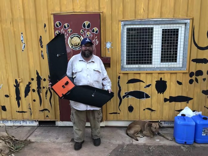
Drone used to survey rock art in the Red Lily Lagoon area. Ian Moffat
Our research used high-resolution elevation data, created from plane and drone surveys, to understand the placement of rock art sites throughout the landscape. We also mapped buried landscapes using imaging techniques to understand how the landscape has changed over time.
We used this data to understand how much of the landscape could be seen from each rock art site during each period of landscape evolution. We also examined what type of landscape was visible from each location.
This is the first time this approach has been used in Arnhem Land. The results provide new insights into what inspired people to create rock art at different times in the past.
Valuable mangroves
Importantly, we found rock art production was most active, diverse in style, and covered the most area of the plateau during the period when mangroves completely covered the floodplains.
This may be because the mangroves provided abundant resources which sustained a large and stable human population. Or perhaps it was a response to the substantial contraction of available land caused by the sea level rise.
We also found that during the period when the sea level was rising, rock art was preferentially made in areas with long-distance views over areas of open woodland.
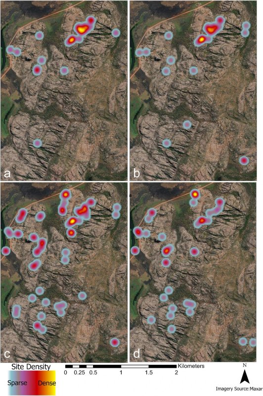
Site placement density by environmental phase: a Sea Level Rise phase, b Transgressive phase, c Big Swamp phase, and d Freshwater phase. Credit: Archaeological and Anthropological Sciences (2023). DOI: 10.1007/s12520-023-01917-y
This may have been to facilitate hunting, or to allow careful management of landscapes during a period when many people would have been displaced from the north by sea level rise.
Detailed landscapes provide deep insights
Overall, our results show people in the past selected locations for rock art placement with intention. These rock art placements have the potential to tell us much more about the archaeology of Arnhem Land.
The locations where art is made have changed fundamentally over time. This reflects significant social and economic changes, which follow the landscape evolution over the long history of human occupation in western Arnhem Land.
Importantly, our results show that considering rock art through the lens of the modern landscape makes it impossible to make sense of the patterns of rock art placement and other archaeological records.
Our work shows more detailed models of the landscape directly surrounding archaeological sites can yield profound insights into past human activities, even those as difficult to interpret as the incredible artwork of Arnhem land.
Provided by The Conversation
This article is republished from The Conversation under a Creative Commons license. Read the original article.