
Did First Settlers From Asia Reached America By ‘Stepping Stone’ Migration Across Bering Sea?
Conny Waters - AncientPages.com - How, when, and where the first Americans made the first daring journey to the Americas is no doubt 'one of the greatest mysteries of our time.'
New answers to this puzzle come from a new study from the University of Kansas and universities in Bologna and Urbino, Italy.
"We digitally discovered a geographic feature of considerable size that had never been properly documented in scientific literature," said principal author Jerome Dobson, professor emeritus of geography at KU.
"We named it the Bering Transitory Archipelago; it existed from about 30,000 years ago through 8,000 years ago. When we saw it, we immediately thought, 'Wow, maybe that's how the first Americans came across.' And, in fact, everything we've tested seems to bear that out -- it does seem to be true."
The Beringian Standstill Hypothesis arises from the fact that today Native American DNA is quite different from Asian DNA, a clear indication of genetic drift of such magnitude that it can only have happened over long periods of time in nearly complete isolation from the Asian source population. The Bering Transitory Archipelago provides a suitable refugium with internal connectivity and outward isolation.
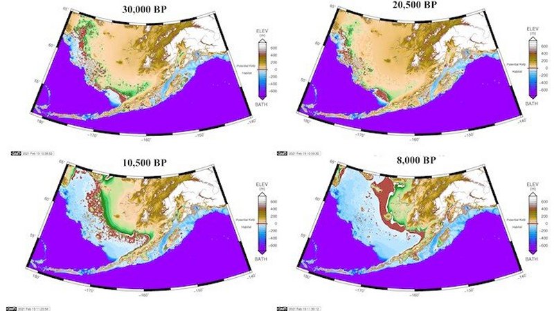
Image credit: University of Kansas
Dobson said people crossing the Bering Sea probably didn't have sails but could have been experienced in paddling skin boats like the kayaks and umiaks that Inuits use today.
"They probably traveled in small groups," he said, "either from Asia or islands off the coast of Asia. Some maritime people are known to have existed 27,000 years ago on northern Japanese islands. They probably were maritime people -- not just living on islands, but actually practicing maritime culture, economy and travel."
Dobson recently received the American Geographical Society's Cullum Geographical Medal (the same gold medal that Neil Armstrong won for flying to the moon and Rachel Carson won for writing "Silent Spring"). He named and continuously champions "aquaterra" -- all lands that were exposed and inundated repeatedly during the Late Pleistocene ice ages -- thus creating a zone of archeological promise scattered offshore from all coastal regions around the globe.
Recently, Dobson and co-authors Giorgio Spada of the University of Bologna and Gaia Galassi of Urbino University "Carlo Bo" applied an improved Glacial Isostatic Adjustment model to nine global choke points, meaning isthmuses and straits that have funneled transport and trade throughout history. Significant human migrations are known to have occurred across some of them, including "Beringia" -- all portions of the Bering Sea that were exposed before, during and after the Last Glacial Maximum.
"These Italian ocean scientists read my 'Aquaterra' paper and took it upon themselves to refine the boundaries of aquaterra for the whole world at coarse resolution and for Beringia itself at fine resolution," Dobson said. "Later we agreed to join forces and tackle those nine global choke points. At the end of that study, we suddenly spotted these islands in the Bering Sea, and that became our focus. This had an immediate potential because it could be a real game-changer in terms of all sciences understanding how migration worked in the past. We found startling results in certain other choke points and have begun analyzing them as well."
In Beringia, the three investigators contend, this action produced a "conveyor belt" of islands that rose from the sea and fell back again, pushing bands of people eastward. "The first islands to appear were just off the coast of Siberia," the KU researcher said. "Then islands appeared ever eastward. Most likely migrants kept expanding eastward, too, generally to islands within view and an easy paddle away."
By 10,500 years ago, when the Bering Strait itself first appeared, almost all islands in the west had submerged. Only three islands remained, and paddling distances had increased accordingly. Thus, occupants were forced to evacuate, and they faced a clear choice: return to Asia, which they knew to be populated and may even have left due to population pressures and resource constraints, or paddle east to less known territory, perhaps less populated islands with ample resources.
"We ourselves are at a stage where we definitely need underwater confirmation," he said. "No doubt underwater archaeologists by title will prevail in that quest, but other disciplines, specialties and fields are essential. Working together plus scouring diverse literature, we presented a fundamentally new physical geography for scientists to contemplate. That should entice every relevant discipline to question conventional theory and explore new ideas regarding how, when and where people came to North America. More broadly, aquaterra can serve as a unifying theme for understanding human migrations, demic expansions, evolutionary biology, culture, settlement and endless other topics."
Written by Conny Waters - AncientPages.com Staff Writer
More From Ancient Pages
-
 Mystery Of The 2,000-Year-Old ‘Urn Burial’ Ceremonies: 113 Tombs Discovered Near the Ancient City Of Fudi
-
 Coclé Lord’s Amazing Tomb Filled With Gold Treasures Found In El Caño, Panama
-
 Enigma Of 3,000-Year-Old Sculpted Head Of Biblical King Discovered In Israel
-
 1.5-Million-Year-Old Hand Axes And Hundreds Of Ancient Artifacts Found In The Iraqi Desert
-
 Hundreds Of Ancient Ceremonial Sites Discovered Near Aguada Fénix – The Largest And Oldest Maya Monument In Mexico
-
 Massive Well-Preserved Second Temple-Era Aqueduct Unearthed In Jerusalem
-
 Mysterious 9,000-Year-Old Shaman Burial In Bad Dürrenberg – One Of Central Europe’s Most Spectacular Archaeological Discoveries
-
 Mystery In Abydos: Carved Rock Chambers Discovered Inside Sacred Mountain
-
 Baby Carriers Were Used 10,000 Years Ago – New Evidence
-
 Secret Tunnel Leads To Christian Chapel In Ancient Suomela Monastery In Turkey
-
 Evidence Of Unknown Ice Age Civilization Discovered In Michigan Ignored By Pipeline Company!
-
 12,000-Year-Old Human Face Depicted On The T-Shaped Pillar – Discovery At Karahantepe, Turkiye
-
 6,000-Year-Old Discovery Of Artifacts Associated With Ancient Lengyel Culture
-
 Apulian Secrets: Ancient Burial Rituals Shed Light On A Culture That Left No Written History
-
 Amazing New Frescoes With Mythological Individuals Discovered At Pompeii
-
 DNA Study Suggests Human Language Emerged 135,000 Years Ago
-
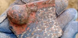
 Priceless 800-Year-Old Treasure Featuring Three Golden Lions Unearthed
-
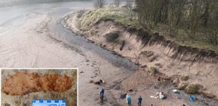 Rare 2,000-Year-Old Footprints Discovered On A Beach In Angus, Scotland
-
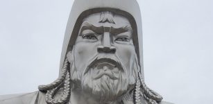 Avraga In Eastern Mongolia Was Winter Base Camp Of Genghis Khan – Study
-
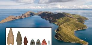 Archery Technology Emerged In The Americas 5,000 Years Ago – Much Earlier Than Previously Thought