
Why Did A Solar Eclipse Save George Davidson’s Life In Alaska?
Conny Waters - AncientPages.com - Scientific curiosity and searching for knowledge can sometimes be dangerous. This is a lesson American astronomer and geographer George Davidson learned when he traveled with his research team to Klukwan, near Haines in southeast Alaska, in 1869.
Ancient people have always been fascinated with solar eclipses, but the understating of this natural phenomenon has varied among civilizations.
Famous Greek philosopher and scientist Thales of Miletus (625 BC - 545 BC), who was recognized as one of the seven sages of ancient Greece, was a brilliant astronomer who predicted an eclipse of the sun that occurred on 28 May 585 B.C.

George Davidson (1825 - 1911). Credit: Public Domain
Ancient civilizations found astronomical phenomena fascinating, and many studied the Sun, Moon, and other celestial objects regularly. Solar eclipses are often used as fixed point-to-date events in the ancient world. Using a combination of a Biblical text and an ancient Egyptian text, scientists have been able to pinpoint the date when world’s oldest solar eclipse took place.
The event, which occurred on 30 October 1207 BC, is mentioned in the Bible and could have consequences for the chronology of the ancient world.
Ancient people studied solar eclipses regularly. Our ancestors were so impressed that some ancient solar eclipses re-wrote history. There were also moments when the darkness of the skies was seen as an omen or sign from God. Some ancient solar eclipses have stayed in the memory of people for generations.
Some civilizations found solar eclipses very frightening, and this fact saved George Davidson's life.
Davidson visited Alaska primarily to observe a total solar eclipse occurring on August 7, 1869. He made his headquarters at an Indian village thirty miles from the mouth of the Chilkat River.
Davidson and his team selected this particular place because they knew it would be particularly clear to observe the upcoming solar eclipse.
However, a Native American tribe in the valley spotted the scientists, and the suspicious locals became angry and threatening.
When Davidson explained that a solar eclipse would occur the following day, the Indians temporarily left them alone.
When the eclipse really happened, the Indians fled, and the sudden darkness saved the scientists' lives. Later, the Indians returned, and they were very impressed with Davidson’s knowledge of the event they had witnessed. The solar eclipse led to a remarkable intellectual potlatch, which is an ancient North American Indian tradition of ceremonial exchange of gifts.
“In the days afterwards, Davidson made a painting on a cedar plank of the sun and its corona, as he had seen it at totality in his specially prepared telescope.”
In exchange, Kohklux and his wives made a large map for Davidson, presenting the complex geography of the main ancient trade routes used by the Chilkat Tlingit. 1
“At his own suggestion Kohklux proposed to draw upon paper his route,” Davidson later noted. “Kohklux started from his place at Klukwan and drew all around the paper and I gave him the back of an old map on which he and his wife drew their routes etc. in 1852.”

A lithograph of the sun and solar corona, as observed by George Davidson at Klukwan, August 8, 1869, appeared in the Coast Survey annual report for 1869.
The chief detailed the long-established trading route up the Chilkat River, over the pass, and through the Southern Tutchone trading centers of Neskatahin, Hutshi, and Aishihik en route to the Yukon River. The Chilkat Tlingit had long maintained strict control over the trade in furs between the interior and the coast. Acting as powerful middle marketers, the Tlingit mediated trade relations between Russian and later Hudson's Bay Company and American maritime merchants. The route that Glave and his party“pioneered” had a long and well-trodden history.
“Lying face downward the old chief and his wife discussed and laboriously drew on the back of an old chart the lines of all the water courses, and lakes with the profile of the mountains as they appear on either hand from the trail… and the limit of each of the fourteen days journey across to Fort Selkirk is marked by cross-lines on this original Chilkat map,” as a National Geographic magazine writer, Eliza Scidmore, explained this episode of indigenous mapmaking. So accurate was the map, according to Scid- more, that “this Kloh-Kutz map was the basis of the first charts.
”But the map was not only a relatively accurate representation of the topographical features of this critical trade route; the map was also a memory.” 2
Written by Conny Waters – AncientPages.com Staff Writer
Updated on April 8, 2024
Copyright © AncientPages.com All rights reserved. This material may not be published, broadcast, rewritten or redistributed in whole or part without the express written permission of AncientPages.com
Expand for referencesReferences:
- John Cloud - The Tlingit Map of 1869, Penn Museum
- Robert Campbell - In Darkest Alaska: Travel and Empire Along the Inside Passage
- Wagner, Henry R. "George Davidson, Geographer of the Northwest Coast of America." California Historical Society Quarterly 11, no. 4 (1932): 299-320. Accessed April 2, 2020. doi:10.2307/25178166.
- Campbell, W. W. "THE ASTRONOMICAL ACTIVITIES OF PROFESSOR GEORGE DAVIDSON." Publications of the Astronomical Society of the Pacific 26, no. 152 (1914): 28-37.
More From Ancient Pages
-
 Aqueducts Are Among Most Exceptional Achievements Of Ancient Roman Engineers
-
 The Hidden Face Of The Elusive Master
-
 Modern Banking Concept Started In Ancient Babylonian Temples
-
 Impressive And Rare Hoard Of Silver Coins Dated To The Hasmonean Period (126 BC) – Studied
-
 Seti I – Remarkable Pharaoh Who Saved The Kingdom Of Egypt And Gave It New Glory
-
 Mysterious People Who Appeared Out Of Nowhere
-
 ‘Be Wise As Serpents And Harmless As Doves’ – The Story Of The Serpent People And Their Guidance
-
 World’s Oldest Wooden Structure Discovered And It Predates Homo Sapiens – Archaeologists Say
-
 Was Hygiene Important For Our Ancestors?
-
 On This Day In History: The Lumière Brothers Presented Their First Film In Paris – On Dec 28, 1895
-
 The Egyptian Dream Book Reveals Ancient Predictions Of The Future
-
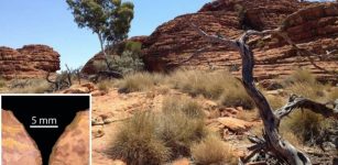 Evidence People Lived In Australian Desert 50,000 Years Earlier Than Previously Thought
-
 Anne Neville – The Dramatical Story Of The White Queen
-
 On This Day In History: Harvard University – America’s Oldest Learning Institution Was Founded – On Oct 28, 1636
-
 Archaeologists Begin Excavations Of A Sunken Zhiyuan Warship That Sank In 1894
-
 On This Day In History: Terracotta Army Buried With Emperor Qin Shi Huang Discovered – On Mar 29, 1974
-
 Ancient Cotton Fibers Dating Back 7,000 Years Discovered In NE Israel
-
 Are Relics In Santi Apostoli Church Really The Remains Of St. James And St. Philip?
-
 Human-Driven Mass Extinction Is Eliminating Entire Branches Of The Tree Of Life – New Study
-
 Neanderthals Had More Children And Lived In Smaller Groups Than Was Previously Thought