
Ancient Enigma Of Mercator’s Amazing Map
A. Sutherland - AncientPages.com - "Only since the late 1700s has it been possible to collect & record truly accurate geographic information." (Encarta Encyclopedia: Geography & Maps, History of...)
However, the statement cannot be true because there are old maps that reveal areas of China, North America, South America, and ice-free portions of Antarctica, long before they had been drawn by explorers.

Planisphere made by Rumold Mercator, 1587. Image credit: Julian Sargent - Public Domain
The ice cap in those portions of Antarctica is now about a mile thick.
There are maps on which Greenland is composed of two separate islands, as it was later confirmed by a polar French expedition, which found out that there is an ice cap quite thick joining two islands.
"The maps were accurate except for one crucial point: they depicted the earth as it would appear if its crust lay in a different relationship to the earth's poles as it does now..."
Mercator or (Gerard Kremer, Gerardius Mercator, Gerhard Kremer) a Flemish writer, astronomer, and mathematician was known under different names.
He was the father of modern map-making. When he was 25, he published his first map in 1537. It was a map of Palestine. Future maps were only more or less copied from Mercator's world atlas published by him in 1585.
His atlas of 1569 replaced his 1538 map, especially the detail of South America. His map dated 1538 was not only accurate but also contained measurements of longitude. Longitude is the distance in degrees west or east of the prime meridian.
It is much more complicated to calculate longitude than latitude, which can be measure by deductions of direction using the sun or the stars for observation.
Longitude, however, requires distance = speed x time and requires a chronometer. In 1761, Harrison's prototype chronometer, solving many naval problems of sailors, has been discovered. In the 19th century, maps began to be updated with correct longitudes.
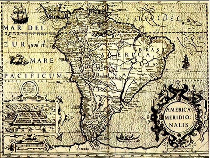
Mercator map 1569.
How could he accomplish this without indispensable technology?
According to Hapgood, only an advanced, worldwide maritime culture that existed more than ten thousand years ago could have created these maps.
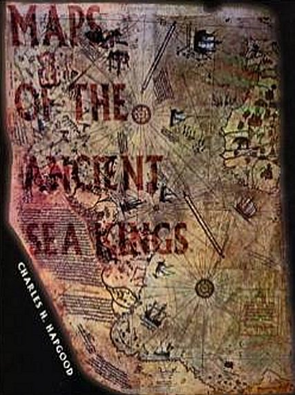
Charles Hapgood’s classic 1966 book on ancient maps is back in print after 20 years. Hapgood produces concrete evidence of an advanced worldwide civilization existing many thousands of years before ancient Egypt. He has found the evidence in many beautiful maps long known to scholars, the Piri Reis Map that shows Antarctica, the Hadji Ahmed map, the Oronteus Finaeus, and other amazing maps.
Hapgood concluded that these maps were made from more ancient maps from the various ancient archives around the world, now lost.
Hapgood also concluded that the ancient mapmakers were in some ways much more advanced scientifically than Europe in the 16th century, or than the ancient civilizations of Greece, Egypt, and Babylonian.
Not only were these unknown people more advanced in mapmaking than any people prior to the 18th century, but it also appears they mapped all the continents.
The Americas were mapped thousands of years before Columbus. Antarctica was mapped when its coasts were free of ice. There is evidence that these "people must have lived when the ice age had not yet ended in the Northern Hemisphere and when Alaska was still connected with Siberia by the Pleistocene, ice age “land bridge.”
Read more in Hapgood’s "Maps of the Ancient Sea Kings: Evidence of Advanced Civilization in the Ice Age".
So it means this maritime culture must exist long before Antarctica was covered by ice.
These enigmatic charts are described in Professor Charles Hapgood's book entitled "Maps of the Ancient Sea Kings". Hapgood and his students at Keene State College began to study a series of ancient, but very accurate maps which Professor found in the Library of Congress, Washington DC in 1960.
Many of the maps reveal an astonishing knowledge of the Earth's true appearance and features. And all that took place at a time when most people did not even know that our planet was round.
Who were these, highly advanced technologically people on our planet, and their skilled mapmakers or cartographers, who were able to map Antarctica and certainly also our other continents from the air?
Written by – A. Sutherland - AncientPages.com Senior Staff Writer
Updated on October 12, 2022
Copyright © AncientPages.com All rights reserved. This material may not be published, broadcast, rewritten or redistributed in whole or part without the express written permission of AncientPages.com
More From Ancient Pages
-
 Peculiar Artifact Discovered In Tomb Of The Warrior Queen Fu Hao
-
 Cassandra: Greek Goddess Who Foretold Cursed Prophecies
-
 On This Day In History: The Battle of Mortimer’s Cross – On Feb 2, 1461
-
 What Was Pax Deorum And How Important Was It?
-
 Syamantaka – Divine Jewel With Magical Powers Was A Gift From The Sun God In Hindu Mythology
-
 Fragments Of 6,500-Year-Old Figurine Of ‘Venus of Egerszeg’ – Unearthed
-
 Unique Roman Artifact Discovered At Vindolanda Was More Than A Good Luck Charm
-
 Island Archaeology Could Be A Model For Space Exploration
-
 On This Day In History: Julius Caesar Assassinated – On Mar 15, 44 BC
-
 Evidence Of Dual Mass Extinctions 260 Million Years Ago – Found
-
 Gigantic Unfinished Stone Structures Cut With Amazing Stone-Working Techniques
-
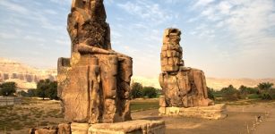 Colossi Of Memnon Guarded Temple Of Pharaoh Amenhotep III And Curious Sound Phenomenon
-
 900-Year-Old Crypt At Old Dongola: Magical Inscriptions And Mysterious Signs Found
-
 What Is The Curse Of The Ninth Symphony?
-
 Ancus Marcius: Semi-Legendary Fourth King Of Rome Obliged To Make War To Defend And Expend Territories
-
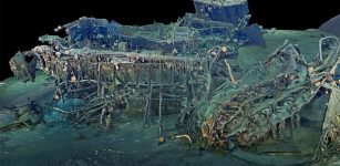 Wreckage From Famous Warships Explored In 3D On Anniversary Of Sinking
-
 Cosquer Cave And Its Magnificent Underwater Stone Age Paintings Created 27,000 Years Ago
-
 Inscription On Pokotia Monolith Reveals Sumerians Visited Peru Thousands Of Years Ago
-
 Illapa: Powerful Master Of Clouds, Rain And Hail – Worshipped By Inca People
-
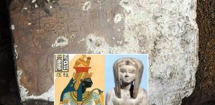 Limestone Stela Of Liberation Discovered In Kom Ombo Temple In Aswan, Egypt