
Never Before Seen 3D Images Of Noah’s Ark Finally Revealed To The Public
Jan Bartek - AncientPages.com - The ship-shaped formation discovered in 1959 in eastern Turkey, by Capt. İlhan Durupınar, an expert cartographer, will be presented in the form of 3D images.
The legend of Noah’s Ark, which has been mentioned in the holy books, is old. For some it is only a legend, for many others, it is an ancient fact that really happened and now it has to be proved.
Many Biblical scholars believe the story of Noah and the Ark was inspired by the legendary flood stories of nearby Mesopotamia, in particular, "The Epic of Gilgamesh."
These ancient narratives were already being passed down from one generation to the next, centuries before Noah appeared in the Bible.

The story of the Great Flood can be found among all ancient cultures. Credit: Public Domain
According to biblical archaeologist Eric Cline, the earlier Mesopotamian stories are very similar where the gods are sending a flood to wipe out humans.
"There's one man they choose to survive. He builds a boat and brings on animals and lands on a mountain and lives happily ever after? I would argue that it's the same story." Several scientists have previously said that the Great Flood and Noah’s Ark were real events.
Reconstruction Of The Legendary Noah’s Ark
Scientists from Erzurum's Atatürk University, Turkey and California University's Los Alamos National Laboratory have spent 26 years investigating the area and the unusual formation.
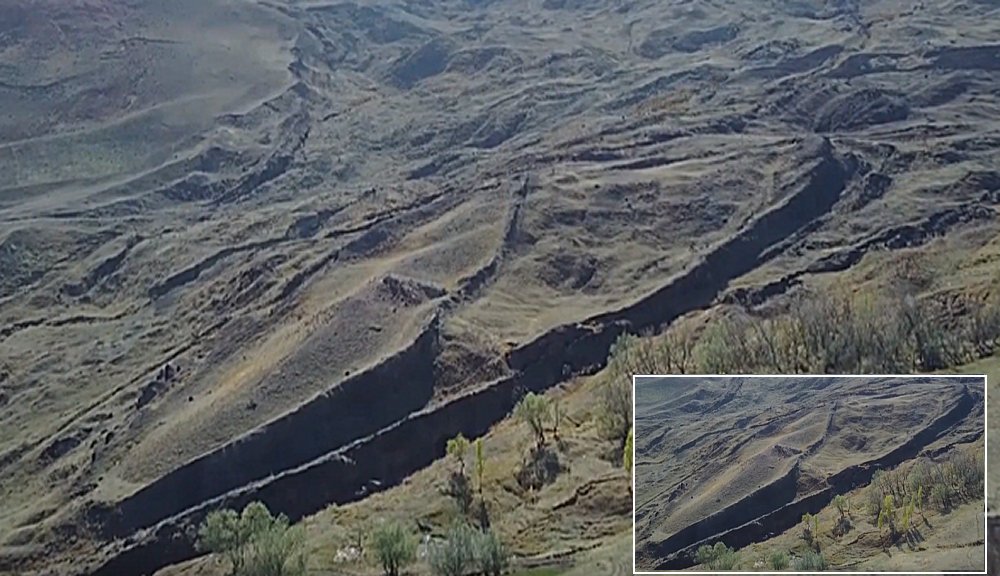 Noah's Ark will be shown in 3D images. Image credit: John Larsen
Researchers think it’s possible to reconstruct the shape of Noah’s ark based on ground-penetrating radar images.
According to an 80-page scientific released to the public, “'it is highly likely that the formation underground is a ship. Archaeological excavations must be launched before winter."
See also:
A Great Flood Destroyed The Mysterious Ancient City Of Petra – Evidence Has Been Found
Can This Ancient Underwater Graveyard Solve The Mystery Of The Great Flood And Noah’s Ark?
Computer Engineer and archaeologist Andrew Jones and Geophysicist John Larsen modeled the formation three-dimensionally to examine it thoroughly and shared their findings with Cem Sertesen, the director of the documentary Noah’s Ark, released in 2017.
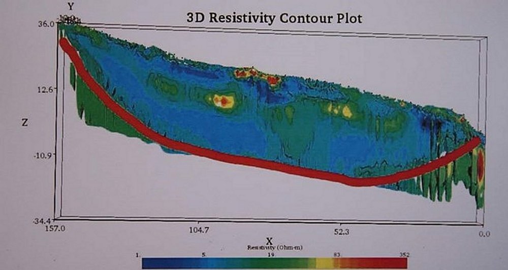 The first 3D image of the remains of Noah's Ark documented by John Larsen and Andrew Jones.
“These are the actual images of Noah's Ark. They are neither fake nor simulation. They show the entire ship buried underground,” Sertesen said.
Sertesen completed the documentary “Noah’s Ark” in 2017 after a 22-year process. He went on to say that the study was carried out to activate the scientific community.
Geophysicists also collect seeds and plants to determine the age of the region, Sertesen added.
 Cem Sertesen, the director of the documentary Noah’s Ark. Image credit: TurkishPress
According to Daily Sabah, “after the publication of the discovery in national newspapers and magazines, renowned photogrammetry and earth scientist Arthur Brandenberger from Ohio University received permission from the military administration and studied the area with his team, but the lab results have remained a mystery as they were never released to the public.”
Something Huge Is Hidden Underground But Is It Noah’s Ark?
Scientists say people shouldn’t jump to conclusions too quickly. It’s too early to say whether this formation is proof of Noah’s Ark.
See also: More Archaeology News
Stressing that the images were gathered by sending electric signals underground via cables, Sertesen said:
“It's a ship, but it's too early to be called Noah's Ark. We have to do a lot of work. This can only be done with the support of universities and the Turkish state,” he said.
Archaeological excavations must be launched before winter and it’s vital to protect the area so scientists can carry out their studies. Geophysicists have already collected seeds and plants to determine the age of the region.
Written by Jan Bartek - AncientPages.com Staff Writer
More From Ancient Pages
-
 Were The Knights Templar Guilty Or Innocent Of The Crimes Laid Against Them?
-
 Mystery Of The Chinchorro Civilization And The World’s Oldest Mummies
-
 Mysterious Prehistoric Statues In Bada Valley, Indonesia Surrounded With Countless Legends
-
 Ancient Giant Amphibians Swam Like Crocodiles 250 Million Years Ago – New Study
-
 Ireland’s Population Was In Decline When Vikings Arrived To Settle
-
 Mysterious Green Light And Ancient Treasures – Cave Of The Gods And Its Secrets
-
 Ptolemaic Workshop For Repairing And Construction Of Boats Unearthed In Sinai
-
 Birds – Mysterious Avian Messengers That Symbolized Bridge Between Humans And Gods In World Beliefs
-
 Ennion: Ancient Master Of Glassblowing And His Legacy
-
 Pharaoh Ramesses I Whose Mummy Was Stolen And Displayed As A Freak Of Nature For 130 Years
-
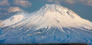 Mount Ararat Was Once Located By The Sea – Study Of Palm Leaves Reveals
-
 Secrets Of The Chephren Pyramid And Its Unknown Mysterious Force
-
 Four Canopic Jars Dated To The 26th Dynasty Unearthed At South Asasif Necropolis, Luxor
-
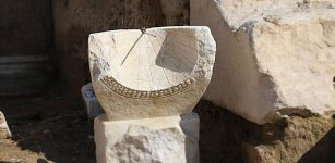 2,000-Year-Old Sundial Discovered In Ancient City Of Laodicea, Turkey
-
 Tooth Enamel Reveals Life Histories Of Early Humans
-
 Mystery Of The Ancient Unknown Mining Civilization In North America – Connecting the Dots – Part 2
-
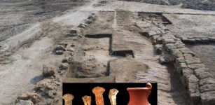
 Fragments Of 6,500-Year-Old Figurine Of ‘Venus of Egerszeg’ – Unearthed
-
 Fearsome Aztec Eagle And Jaguar Warriors Of Mesoamerica
-
 How Gilgamesh Defeated Mighty King Agga Of Kish
-
 Zep Tepi – When Gods Established Their Kingdom On Earth In Egypt