
Fra Mauro Medieval Map: Accurate And Detailed Work Attesting To Advanced Geographic Knowledge Of Contemporary Cartographers
A. Sutherland - AncientPages.com - Monumental map of Fra Mauro is one of the most beautiful and important works in the history of cartography. The map is believed to be the ultimate memorial of medieval cartography. It was the most detailed and accurate map of the world up until that time.
It was created in a monastery on the Venetian island of Murano about 1450.
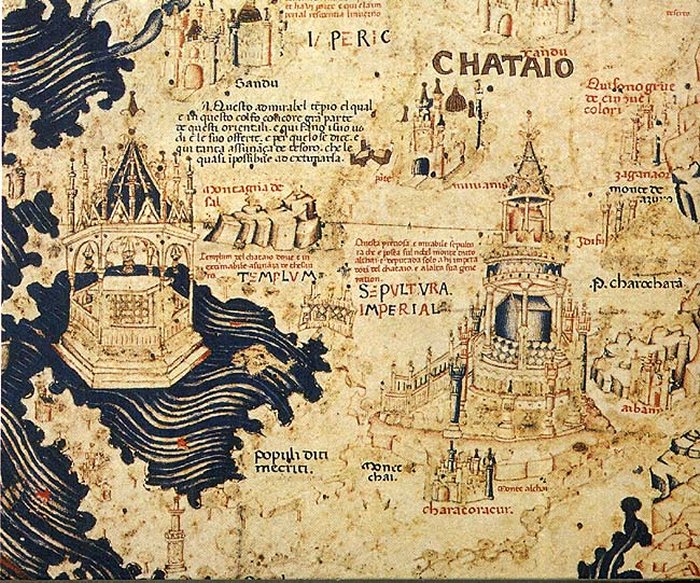
The Fra Mauro Map – Part of China. 1459. Source
The map presents the most comprehensive image of the cosmos as it was known in the mid-15th century. It expresses the Christian vision of the world and the Christian vision of the world disseminated in the early renaissance.
At the same time, Fra Mauro Map announces the decline of the medieval so-called ‘mappae mundi’, whose task was to teach biblical geography. Mappae Mundi were highly influenced by Christianity (with Jerusalem located at the center) and created during the Middle Ages (400-1450) and oriented with the east.
Who Was Fra Mauro?
Fra Mauro who died in 1464, was an Italian cartographer who lived in the Republic of Venice. He traveled much as a soldier and a merchant. He was also a member of the Monastery of St. Michael, situated on the island of Murano, just outside Venice, norther Italy It was there that he maintained a cartography workshop.

The first mention of Java in a Western map. Image credit: Wikipedia
From the 1450s, he is also mentioned as the creator of several world maps. Due to his religious status, Fra Mauro was no longer free to travel, but he could frequently consult with merchants of the city upon their return from overseas voyages.
The Republic of Venice was a sovereign state and a powerful maritime state in northeastern Italy, which flourished for over a millennium between the 7th century and the 18th century from 697 AD until 1797 AD.
Fra Mauro was employed as an accountant and professional cartographer. The map was made for the two most prominent seafaring nations of the time, Venice and Portugal.
Approach To Create The Fra Mauro Map
Fra Mauro clearly tried to use the latest mapping techniques to show the latest discoveries, even if they contradicted the views of classical and Christian geography. He was a cartographer who wanted to definitely break from divinely inspired maps of the Dark Ages.
Although the Earth was inscribed by Fra Mauro in the traditional form of the circle, with a large number of graphic representations of towns and cities, he wanted his map to show an element of a broader cosmological vision, enclosed in a square frame and including paradise and cosmos (shown in the form of three astronomical diagrams).

This detail from Fra Mauro's world map shows the city of Ayutthaya ("Scierno"), a name derived from the Persian name of the city "Shar-I-Nau", meaning "New City". The map is orientated with south to the top. To the right - two cities in Burma can be recognized: "Pochang" (present-day Bagan) and Ava (present-day Inwa). Image credit: Fra Mauro/wikipedia
Appearance And How Long Did It Take To Create It?
One of the attributes of the map is its southern orientation, instead of the northern one, earlier used by Ptolemy and eastern, typical of the medieval mappae mundi, which showed at the top where Garden of Eden was usually depicted.
Fra Mauro wanted to place the Garden of Eden outside the world, rather than in the extreme east.
Other features of this map show that Jerusalem was moved from the center of the world to its periphery, and southern Africa was presented as if it could be circumnavigated - even though the Portuguese were the first Europeans to circle the Cape of Good Hope only in 1488.
The map forms a circular planisphere drawn on parchment and set in a wooden frame that measures about 240 x 240 cm. It includes Asia, the Indian Ocean, Africa, Europe, and the Atlantic. It is oriented with south at the top.

The Fra Mauro map. Europe. 1459. Image credit: PHG/Wikipedia
On the map, there are 3000 inscriptions informing about the latest news from the accounts of people traveling to Africa and Asia. They contain a lot of often very detailed information on both of these continents; one of them is related to the description of Japan.
A large team of cartographers, copyists, and artists worked on the map including Fra Mauro. They used the best-known pigments and gold to achieve the best effects.
The work, which was very expensive and took several years, contains hundreds of very detailed illustrations and more than 3000 descriptive texts.
Fra Mauro map marks the end of Bible-based geography in Europe and the beginning of embracing a more scientific way of making maps, placing accuracy of the mapping ahead of traditional and religious beliefs.
The map is usually on display in the museum Museo Correr in Venice in Italy.
Written by – A. Sutherland - AncientPages.com Senior Staff Writer
Copyright © AncientPages.com All rights reserved. This material may not be published, broadcast, rewritten or redistributed in whole or part without the express written permission of AncientPages.com
Expand for referencesReferences:
James Cowan, A Mapmaker’s Dream
More From Ancient Pages
-
 Eriu: Powerful Irish Goddess And Sacred Uisneach Hill Where She And God Lugh Are Buried
-
 Unique Belongings Of Bronze Age Warrior Offer Evidence Of Massive Violent Conflict In Europe
-
 Ancient DNA From Medieval Germany Reveals The True Story Of Ashkenazi Jews
-
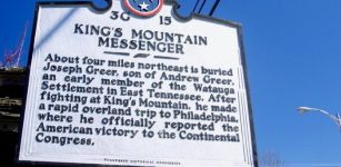 On This Day In History: Battle Of King’s Mountain Was Fought – On Oct 7, 1780
-
 Secret Ancient Knowledge Of Portals Leading To Unknown Realms -The Arrival And Departure – Part 1
-
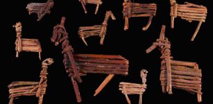 Tusayan Pueblo Ruins And Split Twig Figurines Tell Story Of People Who Once Inhabited The Grand Canyon
-
 Ruins Of Long-Lost Ancient City Of Tenea Built By Trojans Discovered
-
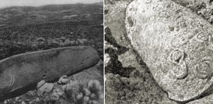 Mysterious 2000-Year-Old Carved Vishap Stone Monuments Of Armenia
-
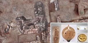
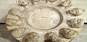 ‘Altar Of Twelve Gods’ At Gabii, Italy Was Once An Important Ancient Place
-
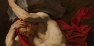 Why Did God Zeus Give King Sisyphus An Eternal Punishment?
-
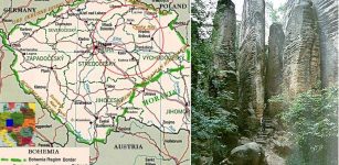 Bizarre Sandstone Towers Of The Rocky Town And Legend Of Jan Svatos Who Mastered Magic
-
 House Of Borgia – The Most Infamous Family Of Renaissance Italy
-
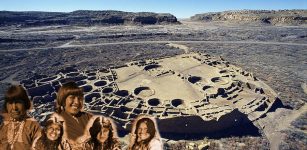 Ancient Chaco Was Organized Society Ruled By Women, Study Suggests
-
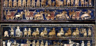 Image Of The Day: ‘The Standard of Ur – War And Peace’
-
 Asgard: Enter The Ancient Kingdom Of The Powerful Norse Gods
-
 Fairies Weren’t Always Cute – They Used To Drink Human Blood And Kidnap Children
-
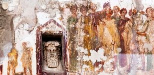 Artificial Intelligence Recreates Pompeii’s Ruined Ancient Masterpieces
-
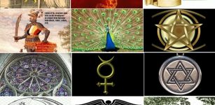 12 Alchemy Symbols Explained
-
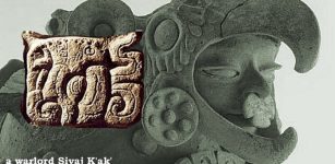 On This Day In History: Powerful Warlord And Emissary Of Spear-Thrower-Owl Arrived At Tikal – On Jan 8, 378 AD
-
 Unexplained Accounts Of Mysterious Fires – No Traces But It Happened – Part 2