
Satellites Discover Over 160 Hidden Ancient Mounds In North America
AncientPages.com - Using satellites researchers have discovered several hidden North American mounds that could offer valuable information about pre-contact Native Americans and early life of our ancestors, but we need to act quickly and save these ancient structures before they are destroyed.
Many of these mounds are located in places deeply wooded or consist of bayous and swamps, making the structures difficult to spot with sophisticated technology.

The team's approach successfully identified ring and mound sites (indicated by arrows) within a stretch of forest that had not been previously surveyed by archaeologists. Credit: Carl Lipo
This is why scientists are relying more and more on LiDAR (light detection and ranging) to gather data about previously unknown ancient archaeological sites. Aerial sensors such as LIDAR are particularly effective at showing the characteristic rises in topography that mark the presence of mounds.
Researchers at Binghamton University, State University at New York have used LIDAR and identified over 160 previously undetected mounds in North America.
“Across the East Coast of the United States, some of the most visible forms for pre-contact Native American material culture can be found in the form of large earthen and shell mounds," Binghamton University anthropologist Carl Lipo said in a press release.
"Mounds and shell rings contain valuable information about the way in which past people lived in North America. As habitation sites, they can show us the kinds of foods that were eaten, the way in which the community lived, and how the community interacted with neighbors and their local environments,” Lipo added.
See also:
Emerald Mound In The Ancient City Of Natchez: Second Largest Temple Mound In North America
Grave Creek Mound – One Of North America’s Most Curious Ancient Monuments
Object based image analysis (OBIA) allows archaeologists to configure a program to automatically detect features of interest. This technology was used in areas like coast South Carolina, with large swaths of shallow bays, inlets and bayous that are covered in forest.
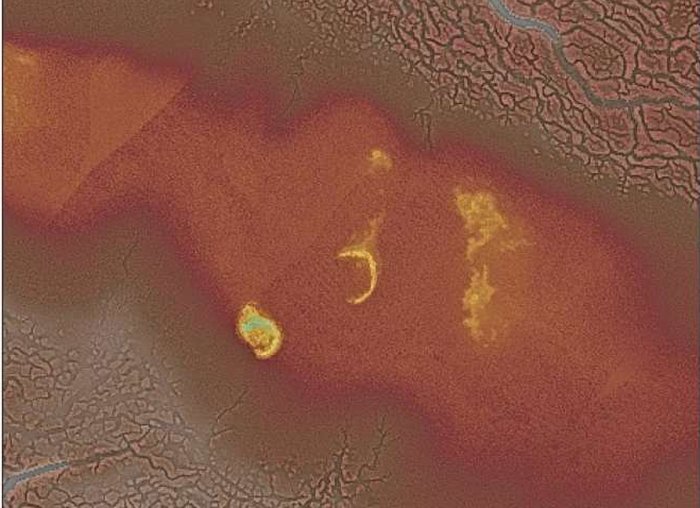 Two previously identified shell rings on Daws Island, S.C. These features were also picked up by the new approach utilized by Davis, Sanger, and Lipo (2018). Credit: Carl Lipo
"Fortunately, satellite and LiDAR data are now available for much of the eastern seaboard, so undertaking a large-scale project is now a task that is achievable," said Lipo.
"Due to climate change and sea-level rise, many major mounds and middens on the East Coast are threatened by erosion and inundation. It is urgent we document this pre-contact landscape as soon as possible, in order to learn as much as we can about the past before it is gone forever."
It’s vital that scientists can collect information about these ancient mounds before their existence is erased from history.
AncientPages.com
More From Ancient Pages
-
 Puzzling Markings Carved On Ancient Artifacts Discovered In North America – Unknown Native American Tribe, Lost Civilization Or Something Else?
-
 On This Day In History: Joan Of Arc Enters Orleans, The City Besieged By The English – On Apr 29, 1429
-
 ‘Yunatsite’ And Thought-Provoking Theory That Balkan Peninsula And Not Mesopotamia Was The Cradle Of Civilization
-
 Unexplained Lights Over English City Reported By Police May Have A Deeper Meaning
-
 Early North Americans Much More Diverse Than Previously Believed
-
 The Use Of Surnames Started During The Middle Ages In England
-
 Yungang Grottoes: Marvellous Example Of Ancient Buddhist Rock-Cut Architecture
-
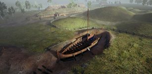 Archaeologists Reveal 12 Exciting Finds From The Gjellestad Viking Ship Dig
-
 Mystery Of Sacred Groves Of Oshogbo And Its Remarkable Ancient Figures
-
 Excavations In Ancient City Of Cremna – One Of The Five Colonial Cities In Pisidia
-
 Ancient Vietnamese Bronze Dong Son Drum Accidentally Discovered
-
 History Of Bread: Basic Food Of Man In Ancient And Contemporary Cultures Around The World
-
 Confucius: Philosopher, Educationist And Great Intellect With A Noble Morality
-
 Troublesome Momus: Deity Of Irony, Ridicule, Sarcasm And Harmful Jokes In Greek And Roman Mythology
-
 Ancient Mayans Used Saunas For Healing Purposes
-
 Ceibal Is The Oldest Known Ceremonial Site Of The Maya Civilization
-
 Rene Descartes – Independent French Thinker And His Main Ideas
-
 Interesting Relief Sculpture Of Pharaoh Hatshepsut Found At Swansea University
-
 Secret Ancient Knowledge Of Portals Leading To Unknown Realms – Mysteries Of The Past And Present – Part 2
-
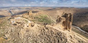 What Are The Huge Ancient Structures Beneath The Zerzevan Castle Discovered By Radar?