
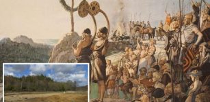
Ancient Egyptian Capital Tell El-Amarna Mapped Through Satellite Imagery System
Ancient Pages.com - Researchers work with the layout of Tell el-Amarna, ancient Egypt's capital during the reign of pharaoh Akhenaten (1353B.C–1336B.C using remote sensing techniques.
Based on images obtained from those of Google Maps after some processing to enhance their details, researchers are able to to survey the archaeological site of Amarna, Egypt, according to the Ministry of Antiquities.
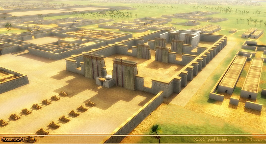
The Small Aten Temple This view is roughly easterly in direction and shows the Small Aten Temple which was close to the Pharaoh’s quarters on the left. Credits: Paul Docherty Principal Lecturer in 3D CG Teesside University
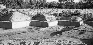
The discovery is attributed to a spatial high resolution satellite imagery system that was carried out by the archaeology mission of Belgian University of Leuven, currently excavating at Amarna on the east bank of Upper Egypt’s governorate of Minya.
“The team captured and analyzed images from satellites orbiting 450 kilometers above the earth, equipped with advanced cameras,” said Antiquities Minister Mamdouh al-Damatysaid, adding that the images showed “the city’s northern tip contained large number of mines, quarries and served as an industrial hub.”
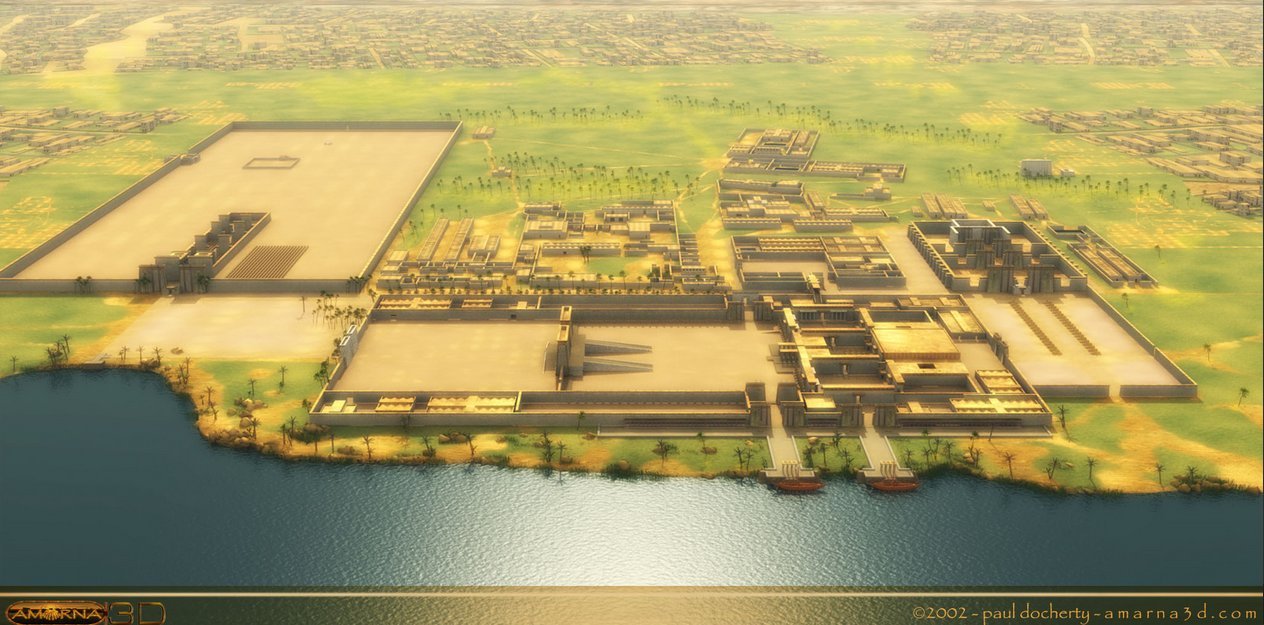
Perspective view of the early city model. Credits: Paul Docherty Principal Lecturer in 3D CG Teesside University
The images also showed a detailed layout of the ancient city including its main streets, sections used for burial, ramps and transportation paths from the mines to the harbor.
The site of Amarna is located on the east bank of the Nile River in the modern Egyptian province of Minya, some 58 km south of the city of al-Minya, 312 km south of the Egyptian capital Cairo and 402 km north of Luxor.
Akhenaten's Tell el-Amarna (or simply Amarna) was the short-lived capital built by the 'heretic' Pharaoh Akhenaten and abandoned shortly after his death (c. 1332 BCE).
The site of Amarna includes several modern villages, chief of which are el-Till in the north and el-Hagg Qandil in the south.
The area contains an extensive Egyptian archaeological site that represents the remains of the capital city newly–established and built by the Pharaoh Akhenaten of the late Eighteenth Dynasty (c. 1353 BC).

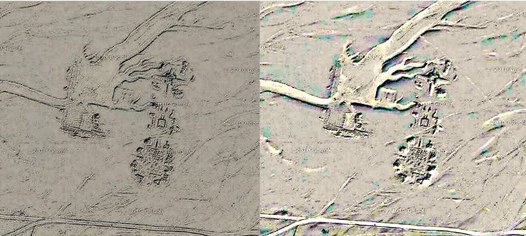
Amarna processed images. Source
The name for the city employed by the ancient Egyptians is written as Akhetaten (or Akhetaton – transliterations vary) in English transliteration. Akhetaten means "Horizon of the Aten".
Two years after ascending the throne of Egypt, Akhenaten overthrew the old gods in favor of the solar god Aten. He also abandoned Thebes, [now Luxor] Egypt’s historical capital city and built a new capital dedicated to the Aten’s worship in Minya’s east bank.
The city was abandoned and deliberately ignored by followers of God Amun shortly after Akhenaten’s death.
The area was also occupied during later Roman and early Christian times and excavations to the south of the city have found several structures from this period.
AncientPages.com
Expand for referencesMore From Ancient Pages
-
 Earth’s First Animals Had Particular Taste In Real Estate
-
 Ancient DNA Reveals Surprising Stories About Migrations And Genetic Mixing Of Our Ancestors
-
 On This Day In History: Feast Day Of The Venerable Bede – Remarkable Priest, Monk And Scholar – On May 25, 735
-
 The Battle Of The ‘Cloudships’ – Strange And Unexplained Sightings In The Skies
-
 China’s 4,200-Year-Old Taosi Ruins Confirmed As Ancient Capital Of Legendary Emperor Yao
-
 Unexplained Mystery Of A Painting That Has Been Labeled ‘Evil’
-
 Vikings: Facts And History About The Tough Norse Seafaring People
-
 Sobekneferu: First Female Pharaoh In Ancient Egypt
-
 A 1.3 kg Heavy Bronze Sword Unearthed On Funen Island, Denmark
-
 Sumerian Plaque Dedicated To King Ur-Nanshe, The Founder Of The 1st Dynasty Of Lagash
-
 Florida’s Ancient Underwater Burial Site Much Older Than Previously Thought
-
 Newport Ship: Experts Reassemble Medieval Vessel Found In The Mud
-
 82 Mysterious 3,000-Year-Old Pits Discovered In Sweden – Bronze Age Cooking Pits And Ancient Ceremonial Center?
-
 Mystery Of Ancient, Overlooked Calico: Early Man Site In The Mojave Desert Of North America
-
 Ancient Aqueduct System Discovered In Boroujerd, Lorestan
-
 What Really Happened To Library Of Alexandria Remains A Mystery
-
 Ancient Rock Engravings Unveil Intriguing Insights Into Human Cultures
-
 Rosicrucian Secret That Was Never Meant To Be Revealed
-
 The Perplexing Story Of The Seven Continents And The Seven Mysterious Races – Distant Past – Part 1
-
 Gigantic Neolithic Newgrange Monument: A Temple, Astronomical Observatory Or Ancient Tomb?